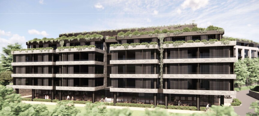
 Image of development from the EIS
142–150 Narrow Neck Road, Katoomba
Why the Roads Can’t Cope
The road network around Narrow Neck is already under pressure - and it was never designed to handle a large influx of new residents or vehicles. Anyone who lives or drives in Katoomba knows that congestion is now a daily reality, and that many local streets are narrow, winding and unsafe for pedestrians.
Regular Congestion and Limited Access
Narrow Neck Road is a single-lane, winding route often shrouded in fog - a frequent hazard near the escarpment. During peak hours, traffic can already be heavy, and there are no footpaths connecting the area to the shops or station. Pedestrians must walk on the road or on uneven ground, creating a real safety risk.
Further along, Neale Street becomes a single lane when cars are parked on one side - and completely impassable when parked on both. With only two highway entrances eastbound (Parke and Bathurst Streets) and two westbound (Parke and Kulgoa Streets), the local network has very limited capacity. Parke Street, the main access point, is congested most of the time, with queues often stretching down to Waratah Street.
The assumption that a railway station makes the area “well-serviced” is also misplaced. The Blue Mountains does not have a robust public transport network. Most residents rely on cars for shopping, work, school and medical access. Adding hundreds of extra residents would mean hundreds more vehicles on roads that are already at their limits. Increased noise, pollution, and headlight glare will also impact surrounding homes, particularly along Narrow Neck Road.
Evacuation Constraints and Emergency Risks
All routes from the proposed development to the Great Western Highway pass through bushfire-prone areas - whether via Narrow Neck Road, Kamillaroi Road, Neale Street or Cliff Drive near the Scenic Railway. These routes are already known choke points, further complicated by tourist traffic around lookouts and attractions.
The Great Western Highway is the only evacuation route east and west, and a single accident can block it in both directions. During the 2013 Springwood–Winmalee bushfires, the highway became paralysed, trapping residents and emergency services alike. With more cars and people in the area, that risk would multiply.
In an emergency, fire trucks and ambulances would struggle to move through narrow, congested local roads, putting lives at risk. These risks are cumulative and cannot be assessed in isolation at the development stage. They must be recognised at the strategic planning level before approvals are granted for large-scale development in high-risk, low-capacity areas like the Blue Mountains.
The proposal for high-density housing at Narrow Neck ignores the realities of this landscape. Our transport and evacuation infrastructure is already stretched. Adding more vehicles, more people and more pressure will not only worsen daily congestion - it could prove catastrophic in an emergency.
The Blue Mountains is still not another suburb of Sydney - and our road network should never be treated as if it were.
You'll receive regular information and updates on the Society campaign to oppose this development, and its many other activities.
We acknowledge the traditional custodians of this land
the Darug and Gundungurra people
and pay respect to their Elders past and present.