♦ GBMWHA 2019-20 Bushfire Impacts
♦ GoS2 2019-20 Bushfire Impact
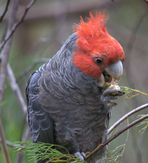 Gang-gang Cockatoo (Anne Ashford)
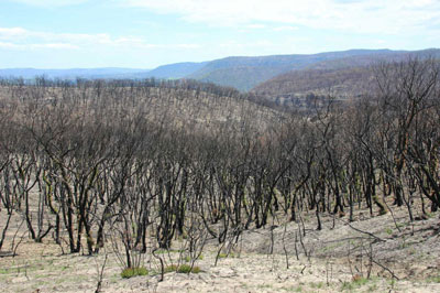
Here in the Blue Mountains the extent of the fires has greatly exceeded any previous recorded fire seasons. Over 80% of the Blue Mountains National Park has been impacted with 63% partly or fully burnt. In the Greater Blue Mountains World Heritage Area of over one million hectares (eight reserves including the Blue Mountains National Park), over 68% has been fully or partly burnt and over 122 million mammals, birds and reptiles have been impacted.
Genetic diversity in the area will be greatly reduced, species may be lost from the area. Many species, and possibly ecological communities, will be locally threatened. Our world renowned biodiversity is at risk and it is imperative that we work to restore and protect it.
Prolonged and extreme high temperatures with greatly reduced rainfall, extraordinarily low humidity and periods of high winds, have produced fire conditions and behaviours not seen on such a wide scale before in the Blue Mountains or Australia.
This extreme conditions exemplify the predictions of climate scientists in regard to the impacts of global warming and rapid climate change.
The society 's priorities will be to advocate for the urgent recovery and protection of our precious national parks including sufficient funding and resources and for real action on climate change.
Here's our full Bushfire Statement (Jan.'20) and the Gazette article (30 Jan.'20)
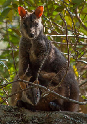 Brush-tailed Rock-wallaby (female) and joey
Wollemi National Park (Ian Brown)
These figures are the result of detailed analysis by Peter Smith provided in his paper - Impact of the 2019-20 Fires on the Greater Blue Mountains World Heritage Area
The burnt area of each of the eight reserves of the GBMWHA has been calculated.
Peter has also calculated the number of animals impacted by multiplying likely densities of animals* in unburnt habitat by the number of hectares burnt.
The densities are very rough estimates, but are the best available for NSW.
In any case, it is clear that huge numbers of animals have been impacted and most of them have died as a result of the drought, the fires and the shortage of food, water and shelter after the fires.
The unprecedented scale of the fires, leaving few unburnt refuges from which to recolonise, makes the recovery of the fauna highly problematic.
Here's two bushfire maps of the GBMWHA.
The first map (8MB) shows the burnt and unburnt areas of the GBMWHA including whether the canopy is burnt.
The second map, produced by the Federal Dept. of the Environment, has more geographical detail and also shows burnt areas outside of the GBMWHA - but doesn't show the extent of the burn (canopy, understory, etc.).
Both maps are vector PDFs so you can zoom in on them.
GBMWHA Reserve |
Area (ha) | Burnt (ha) | % Burnt |
Wollemi NP |
502,600 | 380,826 | 76 |
Blue Mountains NP |
269,200 | 196,381 | 73 |
Yengo NP |
167,600 | 155,927 | 93 |
Kanangra-Boyd NP |
71,600 | 62,646 | 87 |
Nattai NP |
50,660 | 43,467 | 86 |
Gardens of Stone NP |
15,120 | 12,693 | 84 |
Jenolan KCR |
3,146 | 3,078 | 98 |
Thirlmere Lakes NP |
662 | 292 | 44 |
Total GBMWHA |
1,080,588 | 855,310 | 79 |
Fauna |
Number impacted by GBMWHA fire |
Mammals (excl. bats) |
15.0 million |
Birds |
17.7 million |
Reptiles |
110.4 million |
Total GBMWHA |
143.1 million |
[* Density of mammals, birds and reptiles in NSW is based on C. Johnson, H. Cogger, C. Dickman and H. Ford (2007), Impacts of Landclearing: The Impacts of Approved Clearing of Native Vegetation on Australian Wildlife in New South Wales, WWF-Australia, Sydney.]
GoS2 is the proposed Gardens of Stone State Conservation Area (Newnes, Wolgan and Ben Bullen State Forests)
 Extreme severity fire, Bell (Peter Smith)
These figures are the result of detailed analysis by Peter Smith provided in his paper - Impact of the 2019-20 Fires on the Proposed Gardens of Stone State Conservation Area
Fauna |
Number impacted by GoS2 fire |
Mammals (excl. bats) |
573,000 |
Birds |
677,000 |
Reptiles |
4,224,000 |
Total GoS2 |
5,474,000 |
It may take a few moments to load and you'll need to scroll down to see the text with the associated background map showing the increasing extent of the bushfire.
Caution: This presentation (like many other media) includes some errors on Blue Mountains fires, so there may be more. For instance, it was not the ‘Gospers Mountain fire’ that impacted Bilpin, but the fire that originated with a backburn near Mt Wilson, which became a completely separate fire and was then labelled as the ‘Grose Valley fire’. Also, while the view that wilderness fires are hard to put out is generally true, some of this season’s remote lightning strikes in the Blue Mountains were either not attacked or attacked weakly due to resource constraints and other issues. It is understood that 20 other lightning strikes were put out in the Greater Blue Mountains World Heritage Area this season. The statement that there are not many ‘breaks’ in wilderness to help with firefighting is also partly true. In the Greater Blue Mountains, many breaks such as gorges, watercourses and rainforest were used effectively, and others could have been used.
Here's the ABC's How heat and drought turned Australia into a tinderbox.
- The bits that didn’t burn - NSW’s unburnt parks as biodiversity arks (Gary Dunnett, Executive Officer, National Parks Association of NSW, February 2020)
- Blue Mountains World Heritage and Bushfire (Roger Lembit, Ecologist, February 2020)
- Statement on current fire crisis in Australia (Australian Entomological Society, January 2020)
- Greenies, arson & bushfires - A summer of disinformation (Friends of the Earth Australia, January 2020)
- Sudden forest canopy collapse corresponding with extreme drought and heat in a mediterranean-type eucalypt forest in southwestern Australia (Murdoch University, 2013)
- Understanding the impact of the 2019-20 fires (NSW Government, January 2020)
- More than one billion animals killed in Australian bushfires (Sydney University, January 2020)
- Widespread species devastation following 'unprecedented' fires (Sydney Morning Herald, January 2020)
- Smokescreen (Ian Brown, Environmental consultant and former national park manager (December 2019))
- Causes and consequences of eastern Australia's 2019–20 season of mega-fires (Global Change Biology, Letter To The Editor, December 2019)
The uncertainty is caused by -
- the extensive loss of flora and fauna - this may affect the number and location of endangered flora, fauna and ecosystems
- unable to access many of the impacted areas to assess the damage
- the effect drought and now heavy rain has had on the burnt areas
- the effect climate change continues to have
- the willingness of governments to commit resources to the recovery for the long term
- the ability to protect the unburnt areas so they can provide a fauna refuge and seedbank to the burnt areas - both within and outside the national parks.
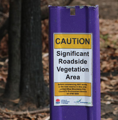 Significant Vegetation Area (Alan Page)
"Biodiversity hotspots" that local conservationists are familiar with need to be quickly assessed and protected.
It is also suggested that appropriately resourced studies be undertaken that will provide a better understanding and metrics of the impact that this bushfire has had .
There's a backdrop that underpins the recovery, and that is even without the recent bushfires and heavy rain, that the Greater Blue Mountains was undergoing a transition due to climate change. Trees and scrubs were dying due to the drought; rainforests were drying out; fauna were moving to find new sources of food.
Sustaining the recovery effort now that it's off the front page is crucial.
- Here's the NSW Government's Wildlife and Conservation Bushfire Recovery document.
Here are the 2020 reports from the Royal Commission into National Natural Disaster Arrangements and the NSW Independent Bushfire Inquiry (all documents are around 18MB each):
- The Royal Commission into National Natural Disaster Arrangements Report and Appendices
- NSW Independent Bushfire Inquiry Report
And here's the Society's submission to the NSW Independent Bushfire Inquiry.
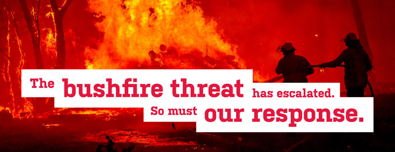
The 2020 National Bushfire and Climate Summit brought together hundreds of participants from across the country and the world to share their experiences, and to formulate recommendations to address the worsening risk of devastating bushfires fuelled by climate change.
The Australian Bushfire and Climate Plan is the culmination of that effort.
The Australian Bushfire and Climate Plan provides a broad plan and practical ideas for governments, fire and land management agencies and communities to help us mitigate and adapt to worsening fire conditions.
The plan’s 165 recommendations include many measures that can be implemented right now, to ensure communities are better protected.
The experts agree: We must tackle climate change and worsening extreme weather by urgently phasing out fossil fuels.
The Blue Mountains Conservation Society participated in this summit and endorses this plan.
An ad for the plan appeared in The Australian on 1st August.
It's early days in the recovery - very early.
We'll keep you informed with updates and articles on this journey. And we'll be asking you to be involved in various activities over the next few years. Activities including events and writing submissions, and generally supporting our initiatives.
We'll endeavour to present clear and correct views without the spin and half truths that have unfortunately been part of the reporting in some quarters of the media. [For example, arsonists were not a major cause].
And please give some thought to donating to the Foundation of National Parks and Wildlife or WIRES (NSW Wildlife Information, Rescue and Education Service). But do your own research.
Lastly, when bushwalking - especially in burnt and recovering areas - please stay on the designated tracks.
 Broad-leaved Geebung on Narrow Neck Plateau (Alan Page)
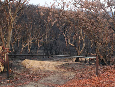 October Creek Gate, January 2020 (Alan Page)
Amidst the horror of this season there has been much talk of the fires being unpredictable and unmanageable, of ‘mega-fires’ that were too big to put out.
It's true that we have seen unprecedented dryness in the landscape (driven by climate change), burning on a vast scale and shocking fire behaviour. But a sense of helplessness is not helpful.
Firefighting and community efforts have not been helpless, they have been heroic and admirable, but are there things we can do, at the operational level, to manage fires better? Could we reduce the size of fires and hence their impact on both people and the environment, even in these difficult times? Many fire managers and fire scientists think so.
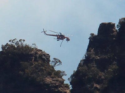 Gypsy Lady above The Three Sisters, December 2019 (Alan Page)
You could easily think that the crews out there on the ground decide strategies and make key decisions.
But the activity you see is the ‘tip of the spear’, with a large and complex operation driving it.
Here’s a ‘short course’ on NSW fire operations.
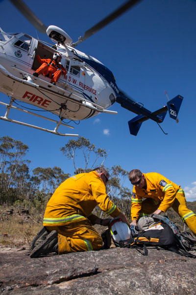 Another load arrives at the fireground, Wollemi National Park (Ian Brown)
‘Remote’ means anywhere not readily accessible to firefighting trucks. Fires that start in such locations, often from lightning, are particularly challenging.
Here's a video clip from The Project about the Wollemi Pines and RAFT
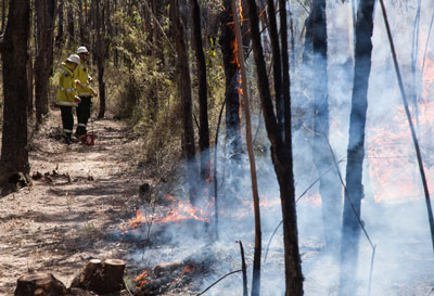 Backburning from a hand-tool line, Wollemi National Park (Ian Brown)
- Are hazard reduction burns effective in managing bushfires? (ABC Fact Check, December 2019)
- 'Adapting to the new normal': NSW to review land management (Sydney Morning Herald, January 2020)
- As bushfire and holiday seasons converge, it may be time to say goodbye to the typical Australian summer holiday (The Conversation, January 2020)
– the Darug and Gundungurra people –
and pay respect to their Elders past and present.

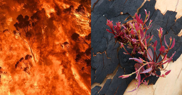 Bushfire & Scribbly Gum regrowth (Blue Mountains Gazette, Alan Page)